top of page

Storm Chase Videos from 2021-2024
LIKE AND SUBSCRIBE to me on YouTube for storm chasing and other interesting weather-related content!
Storm and Nature Photography
Contact me via email (treysweatherblog@gmail.com) if interested in purchasing. Photos can be printed or canvassed, then delivered.
 BLUE MOTHERSHIP: Striations with associated with the mesocyclone of an incredibly blue mothership supercell at sunset near Culbertson, NE. Date: May 23, 2024 |  COLORADO STACKED PLATES #1: Intracloud lightning illuminates the updraft and mesocyclone of a severe supercell storm near Two Buttes, CO. Date: May 29, 2024 |  MINDEN: A large, long-track tornado roars through western rural Iowa hitting the town of Minden. Date: April 26, 2024 |
|---|---|---|
 STORM CHASER'S HOLY GRAIL: A long-lived, slow-moving, and well structured supercell thunderstorm produces a tornado near Paxton, NE. Date: May 23, 2024. |  MAY 10, 2024 AURORA: The auroral curtain and its pillars blazingly light up the evening sky in rural Central Iowa. |  AURORA PILLARS: The emergence of the May 10, 2024 aurora with tall and crisp pillars illuminating the evening sky. |
 THE FARMER'S AURORA Pulsing and vivid aurora illuminates the night sky near Story City, IA in late April 2023. |  ICY MINNESOTA AURORA: We sat out all night in the frigid winter air to watch this gorgeous aurora. Vividly red pillars taken near Worthington, MN in December 2023. |  STORM OF ENCHANTMENT: This picturesque supercell was photographed near Fort Sumner, NM in May 2023. This was part of the Clovis "summer camp" series of storms for all the chasers who know what that means :) |
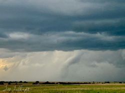 ROPE OUT: May 26, 2021 Tornado in the rope out phase just southeast of Hays, KS. |  IOWA ROPE: A rope tornado taken on a gravel road near Pleasantville, IA, on April 4, 2023. |  CO STACKED PLATES #2 Striated supercell thunderstorm illuminated by lightning near Two Buttes, CO, on May 29, 2024. |
 TOTALITY Here's my totality shot of the Great North American Solar Eclipse of 2024 taken near McCleansboro, IL. | 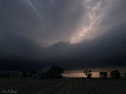 KANSAS AFTER DARK: A massive supercell with a huge inflow tail puts on an insane post-sunset show during our group's storm chase trip. May 24, 2021 |  CONVECTIVE BOMB: May 26, 2021 simply couldn't get much better! Looking back southeast toward a massive towering supercell to our southeast. |
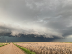 KANSAS SHELFIE: May 26, 2021 After producing a large tornado, our supercell became an HP beast back building on the warm front. | 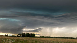 SMOOTH STRUCTURE: An elevated supercell putting out some spectacular structure just east of Northwood, IA. |  SMOOTH STUCTURE 2: Laminar, smooth base underneath an elevated supercell near Northwood, IA. |
 THE OBERLIN, KS MOTHERSHIP: Not much elaboration needed. Simply the best supercell structure I've ever seen. |  OBERLIN IN THE MAKING: The Oberlin, KS, supercell in the making on a classic rural Kansas highway. |  OSAGE IN THE EVENING: Wrapping up our Northern Iowa chase with some high based storms put on a pretty sunset. |
 TURBULENCE AHEAD: Flew over severe storms in the Texas Panhandle in March 2017 on my way to Denver, CO. Photo: Trey Fulbright |  DERECHO #4: July 5, 2022 Intercepted the fourth derecho to impact Iowa in just two years just north of Pocahontas. |  FADING: An LP supercell succumbs to mid-level dry air and a capping inversion. |
 TOWERING HIGH: A high-based storm forms in Northern Iowa in late May 2022. |  THE LITTLE LP THAT COULD: A beautiful LP supercell in Northwest Kansas struggling to maintain itself against a strengthening cap. |  |
 |  |  |
 |  |  |
 |  |  |
bottom of page
